


 Philippines
National
Citizen science program launched to protect, manage PH's mangrove cover
Philippines
National
Citizen science program launched to protect, manage PH's mangrove cover
Citizen science program launched to protect, manage PH's mangrove cover
By Jel Santos


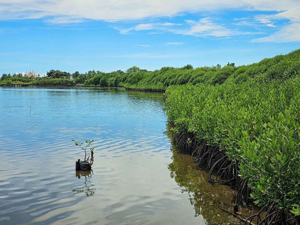
In a bid to protect and manage the Philippines' vital mangrove cover, the Department of Environment and Natural Resources (DENR) has launched a citizen science program that depends on public participation to address the decline of the country’s mangrove forests.
The DENR data showed that Philippine mangrove forests decreased from 450,000 hectares in 1918 to 303,373 hectares in 2015.
Dubbed "BakaJuan," the project calls for practical and relevant public involvement to combat the decline, reflecting the administration's "whole-of-society" paradigm in nation-building.
Environment Secretary Maria Antonia “Toni” Yulo-Loyzaga underscored the power of citizen science in the initiative, calling on the public to take part in tracking and protecting mangroves.
“Amid the climate emergency and destruction of mangroves, everyone has the ability to make a difference by tracking and protecting our natural resources,” she said in a statement.
According to the DENR, “BakaJuan” volunteers can use the ODK Collect app to verify the presence of mangroves in coastal barangays and send drone-taken photographs to the Philippine Space Agency (PhilSA).
The environment department and PhilSA have launched the Nationwide Mangrove Mapping initiative, using the National Mangrove Map 2023, a satellite-based tool designed to detect and validate the country's mangrove cover.
Scientists noted that "BakaJuan" volunteers play a very crucial role in the project's success.
Per the agency, 81 percent of the soft target—4,955 out of 6,110 validation points—had been reached by May 22, and this figure rose to 95 percent, with 5,828 entries, by May 26.
The DENR said it intends to finish validating over 600 sites and 30,000 points across the country by June 2024.
With the target schedule looming close, the DEBR took to its official Facebook page to announce a significant milestone—a 100 percent completion rate of its 6,000 soft targets.
However, it noted that such accomplishment marks only Phase One of the campaign, and the Department intends to release additional information regarding Phase Two in the coming days.
The environment department emphasized the importance of validating the National Mangrove Map to accurately evaluate the nation's natural resources, crucial for bolstering climate resilience and fostering sustainable development.
This initiative aligns with the DENR chief's call to "measure what we treasure," reflecting the government's commitment to safeguarding essential ecosystems.
PH protection vs typhoons
Mangroves, the agency noted, are more than just coastal flora as they are the Philippines' natural protection against destructive typhoons.
In the World Bank's WAVES Program report, the crucial role that mangroves play in minimizing the threat of floods was underscored.
pointed out the role of mangroves in reducing flood threats.
The report stated that ma mangroves provide communities with protection from the worst of storm surges and typhoons, with its trunks and canopies lessening the effects of waves and storm surges, reducing floods; its aerial roots stabilizing sediments, avoiding erosion.
“With the possibility of a La Niña phenomenon looming in the country, foreseen to bring stronger winds and heavy rainfall, healthy mangrove forests become even more crucial,” it stated.
State weather bureau Philippine Atmospheric, Geophysical, and Astronomical Services Administration (PAGASA) forecasted a 62 percent possibility of La Niña emerging between June and August this year.
It can be recalled that President Marcos himself acknowledged the significance of mangrove conservation, highlighting it as a pressing issue of considerable magnitude.